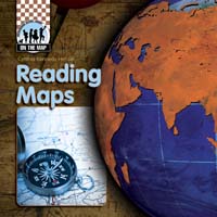
Reading Maps
by Henzel, Cynthia Kennedy
Publisher
Checkerboard Library
Publication
Jan 01, 2008
Series
Format
Paperback/Softback
Illustrated
No
Dimensions
8 x 8 x 1 in
ISBN
9781599289533
Pages
32
Age
8 - 12 years
Category
Science & Nature
Rights Sold
*DropCap does not represent Chinese (Simplified) Print, Chinese (Simplified) Print language rights
Description
Related Titles

Measuring the World
Henzel, Cynthia Kennedy

Mapping History
Henzel, Cynthia Kennedy

Mapmaking
Henzel, Cynthia Kennedy

Creating Modern Maps
Henzel, Cynthia Kennedy

Classifying Maps
Henzel, Cynthia Kennedy

Taj Mahal
Henzel, Cynthia Kennedy

Stonehenge
Henzel, Cynthia Kennedy

Pyramids of Egypt
Henzel, Cynthia Kennedy

Great Wall of China
Henzel, Cynthia Kennedy

Great Barrier Reef
Henzel, Cynthia Kennedy

Galapagos Islands
Henzel, Cynthia Kennedy

| Publisher | ABDO |
| Publication | Jan 01, 2008 |
| Format | Paperback/Softback |
| ISBN | 9781599289533 |
| Pages | 32 |
| Age | 8 - 12 |
| Price |
Categories
Science & Nature
BISAC Codes
JUVENILE NONFICTION / Science & Nature / Earth Sciences / Geography
JUVENILE NONFICTION / Travel
Reading Maps
by Henzel, Cynthia Kennedy
With easy-to-read text and full-color photos, this book introduces readers to the work of a cartographer through several major geographical concepts, including latitude and longitude, projection, scale, and orientation. Readers will become familiar with reading a compass rose and a map legend, as well as learn how to understand a map’s purpose by its title. The book also discusses the different elements used in reference maps and thematic maps, teaching readers that almost any type of information can be mapped. Colorful maps and diagrams highlight the text, visually demonstrating these concepts. Informative sidebars, bold glossary terms, and an index enhance the engaging text and graphics.
Author
Current Licenses(Sold)
Note: DropCap does not represent Chinese (Simplified) Print, Chinese (Simplified) Print language rights.