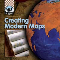
Creating Modern Maps
by Henzel, Cynthia Kennedy
Publisher
Checkerboard Library
Publication
Jan 01, 2008
Series
Format
Paperback/Softback
Illustrated
No
Dimensions
8 x 8 x 1 in
ISBN
9781599289496
Pages
32
Age
8 - 12 years
Category
Science & Nature
Rights Sold
*DropCap does not represent Chinese (Simplified) Print, Chinese (Simplified) Print language rights
Description
Related Titles

Reading Maps
Henzel, Cynthia Kennedy

Measuring the World
Henzel, Cynthia Kennedy

Mapping History
Henzel, Cynthia Kennedy

Mapmaking
Henzel, Cynthia Kennedy

Classifying Maps
Henzel, Cynthia Kennedy

Taj Mahal
Henzel, Cynthia Kennedy

Stonehenge
Henzel, Cynthia Kennedy

Pyramids of Egypt
Henzel, Cynthia Kennedy

Great Wall of China
Henzel, Cynthia Kennedy

Great Barrier Reef
Henzel, Cynthia Kennedy

Galapagos Islands
Henzel, Cynthia Kennedy

| Publisher | ABDO |
| Publication | Jan 01, 2008 |
| Format | Paperback/Softback |
| ISBN | 9781599289496 |
| Pages | 32 |
| Age | 8 - 12 |
| Price |
Categories
Science & Nature
BISAC Codes
JUVENILE NONFICTION / Science & Nature / Earth Sciences / Geography
JUVENILE NONFICTION / Travel
Creating Modern Maps
by Henzel, Cynthia Kennedy
This book walks readers through the improvements made to navigational instruments and printing techniques since the Age of Exploration. The development of accuracy in cartography–from Martin Waldseemüller’s map of the world, the Mercator projection, and Lewis and Clark’s expedition to railroad surveys, roadmaps, satellite imaging, and GIS technology–is also discussed. Readers will also discover ways mapmaking has impacted the history of the United States, including Mountain Men and the discovery of South Pass, the Oregon Trail, and the 49th parallel. Colorful maps and diagrams highlight the text, demonstrating these innovations and milestones. Informative sidebars, bold glossary terms, and an index enhance the engaging text and graphics.
Author
Current Licenses(Sold)
Note: DropCap does not represent Chinese (Simplified) Print, Chinese (Simplified) Print language rights.